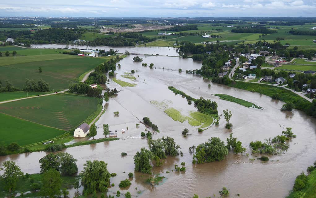
Provincial forecasters were blindsided by conditions that led to flooding in the Grand River watershed June 23, with effects felt in parts of Woolwich Township. That led to the breakdown in the response and communications that followed.
When flood coordinators for the watershed met last month in Cambridge for an annual review of flood systems, that day’s failures were front and center.
The flood of last summer seemed to have caught everyone off guard. Not only the residents of the township, and in particular those in West Montrose who were especially hard hit, but also the forecasters, who were left flatfooted by the extreme weather events occurring to the north.
Jerry Shields, a weather systems coordinator with the Ministry of Natural Resources and Forestry, spoke at the meeting about the government’s forecasts. The ministry bears the main responsibility for forecasting floods in the province, while the GRCA and municipalities are tasked with disseminating the information and responding accordingly.
“So the main part of the talk was about the flooding event that happened on June 23,” said Shields of his presentation at the meeting.
“And the reason we had looked into the details for it was because a lot of the forecast guidance products – the computer products – that we use … did a really bad job that day of forecasting the weather, and a lot of it came by surprise that night. By the time we realized it was happening it was already on top of us. So we want to go back and try to figure out why it happened.”
The ministry is still researching the exact cause of the discrepancy in the forecasts, but Shields said they believe that the unusually heavy rainfall in the watershed was connected with tropical storm conditions in the Gulf of Mexico, which had not been taken into account.
“It seems to be feeding additional moisture into the atmosphere then what’s normally there and it comes all the way up on a low level wind and comes right into southwestern Ontario,” he said.
“And precipitation events that are typically expected often escalate and become more severe and extreme then what we’re used to normally forecasting, and we’re thinking that’s what happened in the situation on June 23.”

It was also likely this same connection between the Gulf and Southern Ontario that caused the flooding in Windsor during Hurricane Harvey late last August.
“We thought that we were on to something, and by that time we saw that here again there was a hurricane that spun up a lot of moisture that came right into southwestern Ontario. This time instead of the Grand River Watershed being part of the problem with the heavy precipitation, it was more or less the Essex-Windsor that had over 200 mm in two days so.”
It was certainly an unusual year weather wise in the Gulf, with several destructive hurricanes making landfall late last summer. Shields is hoping, however, that the Ministry can learn from the hyperactive hurricane season to produce better forecasts in the future.
“We’re now trying to use these tools and develop better forecasting strategies,” he said.
“It was a very active year, so in a way it was helpful for us to see this pattern to be able to actually be able to use it to forecast heavy rainfall events in Ontario. And hopefully in the future if we recognize the pattern again, we’ll do a better job of adding value to what the computer models have and give people who manage water a little more of a head’s up than what they had back in June.”
Following the June flood event, the province made disaster relief funding available to residents and small business owner in West Montrose, as well as in other parts of the watershed.


