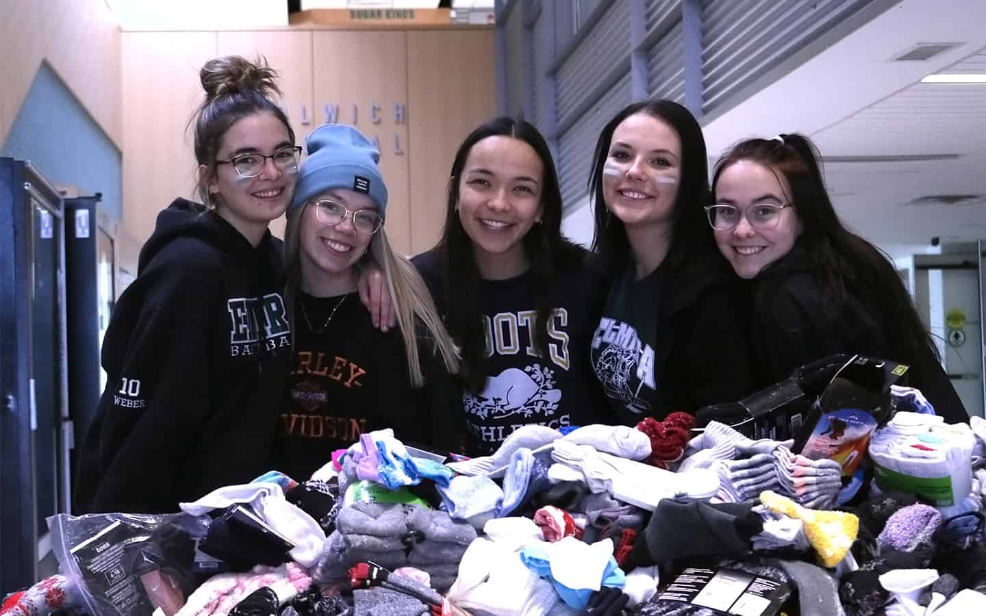
Last night I got out my old box of maps. This is something I do every year around this time, partially in anticipation of spring and partially to see how far my vision has deteriorated.
I use those maps to plan hikes, turkey hunts and fishing expeditions for the upcoming seasons. Those maps also help me understand the lay of the land a little better, so when someone tells me about an incredible backwoods lake that holds brook trout the size of my arm, I can envision the country I’ll get lost in trying to find it.
Paper maps are an old-school thing these days, since younger outdoors enthusiasts tend to use the electronic maps on their phones, computers or handheld GPS units. Or, worse still, they ask for directions.
But, if you ask me, there is still something to be said for paper maps.
- Advertisement -
Let’s begin with the obvious. Electronic units sometimes lose their power or break down – or, for those of us over 55 become “completely stupid, useless and $#%!* dumb!”
At times like these, a good, waterproof paper map and a reliable compass suddenly become your best friends – unless it is an exceptionally windy day.
That is to say, paper maps have certain advantages.
For instance, a good topographic map shows you a wide swath of countryside at a glance. That means you don’t have to scroll up or down, left or right or zoom out on your phone to see that the road you parked your car on is 200 metres away. Map use also saves you from overexerting your thumb as you would on a phone or GPS. That is a debilitating injury that can be life-threatening in this day and age, especially if it prohibits you from texting your better half to explain why you are going to be late for dinner or stops you from fact-checking every little thing on Google. Also, a severe thumb injury can impede your hitchhiking efforts, which means you will have to walk back to your vehicle. And nobody wants that.
Another benefit of paper maps that seems to be forgotten these days is that they are, and have always been, the professional pirate’s choice when it comes marking the secret location of buried treasure.
Look, I have been using various models of handheld and phone GPS units for the last 20 years or more and not once have I ever noted an X on any of the on-screen maps to indicate where a secret, buried treasure is located. I thought I did once, but it was merely a squished black fly.
Yet, a few summers ago I located two Xs on a paper map, denoting where buried treasures were supposed to be. Funny thing, both of those Xs were in our yard.
Actually, to be completely honest, my spouse noticed them first and promptly alerted me. And while I did not find a buried treasure in either location, she soon noticed both holes I dug were in the perfect location and distance apart to plant the posts she happened to have on hand. I’m not sure a clothesline was in Captain Blackbeard’s original plan but at least we got something for my efforts.
I guess what I’m trying to say is that outdoorsmen have been relying on maps in one form or another for at least as long as clotheslines have been around. Also, though GPS and cell phone maps are usually reliable, sometimes they can let you down – just like those $#%!* pirates!